
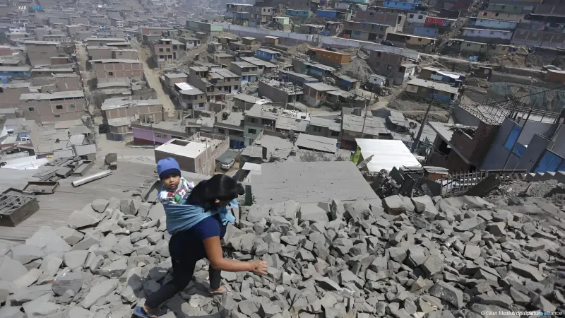
Central Peru was rocked by a powerful 6.7 magnitude earthquake late Friday night, November 21. According to the Peruvian Institute of Geophysics (IGP), the epicenter was located approximately 30 km northwest of the Junin region in the Andes mountain range. The tremors were felt across a significant portion of the country, including the capital, Lima, located 300 km from the epicenter, as well as the cities of Huanuco and the coastal Callao. As of the time of publication, there were no reports of fatalities or injuries, though landslides, rockfalls, power outages, and transportation disruptions were documented.
Timeline and Parameters of the Tremors
According to the IGP, the earthquake occurred on November 20 at 19:09 local time, corresponding to 01:09 CET on November 21. The Institute's President, Hernando Tavera, described the event to AFP as a time when "the earth shook violently," noting that landslides and rockfalls occurred on mountain slopes. The U.S. Geological Survey (USGS) also estimated the magnitude at 6.7 but determined the focal depth differently: the IGP reported 129 km, while the USGS reported 108 km. Thus, both agencies agree on the intensity of the tremors but differ on the depth of the hypocenter.
Consequences and Infrastructure Status
According to preliminary data from the Peruvian Ministry of Defense, no significant material damage has been recorded. Defense Minister Rafael Belaunde emphasized that this is preliminary information and that there are no casualties. In the Junin region, several residential homes were slightly damaged, and power outages and traffic disruptions were reported. Videos posted by local television stations and internet services show residents of Lima and other areas rushing into the streets following the tremors.
Government Response and Monitoring
The Peruvian Emergency Center assessed the intensity of the underground tremors as moderate to high in various areas. The agency stated that "monitoring in high-risk zones is ongoing." In the popular tourist district of Miraflores in Lima, hundreds of people were forced to evacuate offices and buildings. The tremors were also felt in the Ancash, Ica, Ucayali, and Pasco regions, indicating a wide distribution zone of seismic energy.
Geographic Context: The Pacific Ring of Fire
Peru is located in the so-called Pacific Ring of Fire, a zone where several tectonic plates collide, making the country regularly prone to earthquakes. Every year, at least 400 tremors are recorded here, most of which are too weak to be felt by people. The region's history includes tragic events: in July of this year, a 5.1 magnitude earthquake in the Junin region claimed the lives of six people, and on August 15, 2007, a 7.9 magnitude tremor in the Pisco region in the south of the country caused 595 deaths and triggered a small tsunami.
A Series of Strong Earthquakes in Latin America
The November event in Peru fits into a series of powerful seismic events that Latin America has experienced in recent months. In October, a 7.7 magnitude earthquake caused serious damage in Panama; in August, 7.4 magnitude tremors in Colombia claimed at least 294 lives; and in June, two powerful earthquakes rocked Venezuela, where, according to reports, more than 6,500 people died and thousands more are missing. Against this backdrop, the Peruvian earthquake, despite its high magnitude, has currently resulted in no casualties, which authorities attribute to the depth of the hypocenter and the preliminary lack of destruction.