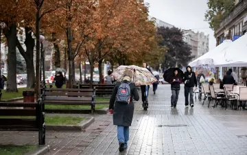
Reports claiming that "first snow" has already fallen in Kyiv and that a full-scale snowfall is expected across Ukraine by the end of next week have been actively spreading in social media and messengers. However, according to Natalia Ptukha, Head of Media Relations at the Ukrainian Hydrometeorological Center, the actual synoptic situation these days may differ significantly from what long-term forecasts show. In a blitz interview with RBC-Ukraine, the expert emphasized that any forecasts extending beyond five days are revised daily or even every 6–12 hours, and their reliability decreases the further into the future they look.
Why "Snowfall by Friday" Is Currently Nothing More Than a Trend
Ptukha acknowledged that certain tendencies toward the first snow in November are indeed visible across Ukraine. Early November and the month as a whole are typical for the emergence of winter weather phenomena. Nevertheless, the atmospheric fronts arriving in the country on November 4–6 will bring predominantly rains, which may occasionally mix with sleet. "This is by no means a classic snowfall, absolutely not, because temperature indicators will still remain above zero," the forecaster specified. For precipitation in the form of sleet to reach the surface, the temperature at a certain altitude must drop to approximately zero; if it is even one degree higher, this narrow temperature interval prevents snowflakes from surviving down to the ground.
What Temperatures the Thermometer Will Show in Early November
Starting around November 3, nighttime temperatures in most regions will range from 0 to +6 °C, and in the south and east of Ukraine up to +10 °C. For comparison: Kyiv currently holds at +10…+11 °C, and a drop to +7…+8 °C will be noticeable, albeit smooth. Daytime temperatures, according to Ptukha's estimates, may drop by literally 3–4 degrees, since nighttime figures will still remain in positive territory. No sharp cold snap is expected over the next week: both late October and early November are characterized by a gradual, "very smooth" temperature decrease. An exception is the high-altitude Carpathians, where sub-zero values and snow or sleet precipitation are already being recorded.
What This Means for Drivers and Residents of Flatland Areas
The forecaster directly recommended that motorists start thinking about changing their car tires now, as prerequisites for mixed-phase precipitation are gradually emerging. At the same time, there is no talk of any stable snow cover in flatland areas yet: without frost, snow, even if it falls, will not linger. Overall in November, forecasts will increasingly feature rain, locally with sleet (indicated by a snowflake icon in the meteorological service), but specific figures and dates can only be reliably named within a three-to-five-day horizon. "What lies further ahead is based on calculations today, but then the atmosphere changes, new calculations take place, and by that date the forecast could be radically different. That happens too. Therefore, we never speak in advance for more than five days," Ptukha summarized.
How to Read Long-Term Forecasts: A Methodological Caveat
The Ukrainian Hydrometeorological Center specialist drew attention to an important methodological nuance: long-term models often cited in social media and weather aggregators are built on averaged calculations and do not reflect the specific trajectory of atmospheric fronts. That is exactly why the "picture" of a snowfall currently visible on the chart for October 30–31 could turn into regular rain or disappear entirely in two or three days. Ptukha urged people to focus on operational forecasts updated every few hours and not to draw far-reaching conclusions based on weekly or monthly models. For planning everyday affairs—from choosing tire types to organizing trips—it is sufficient to track the five-day horizon, which the Hydrometeorological Center considers working and reliable.