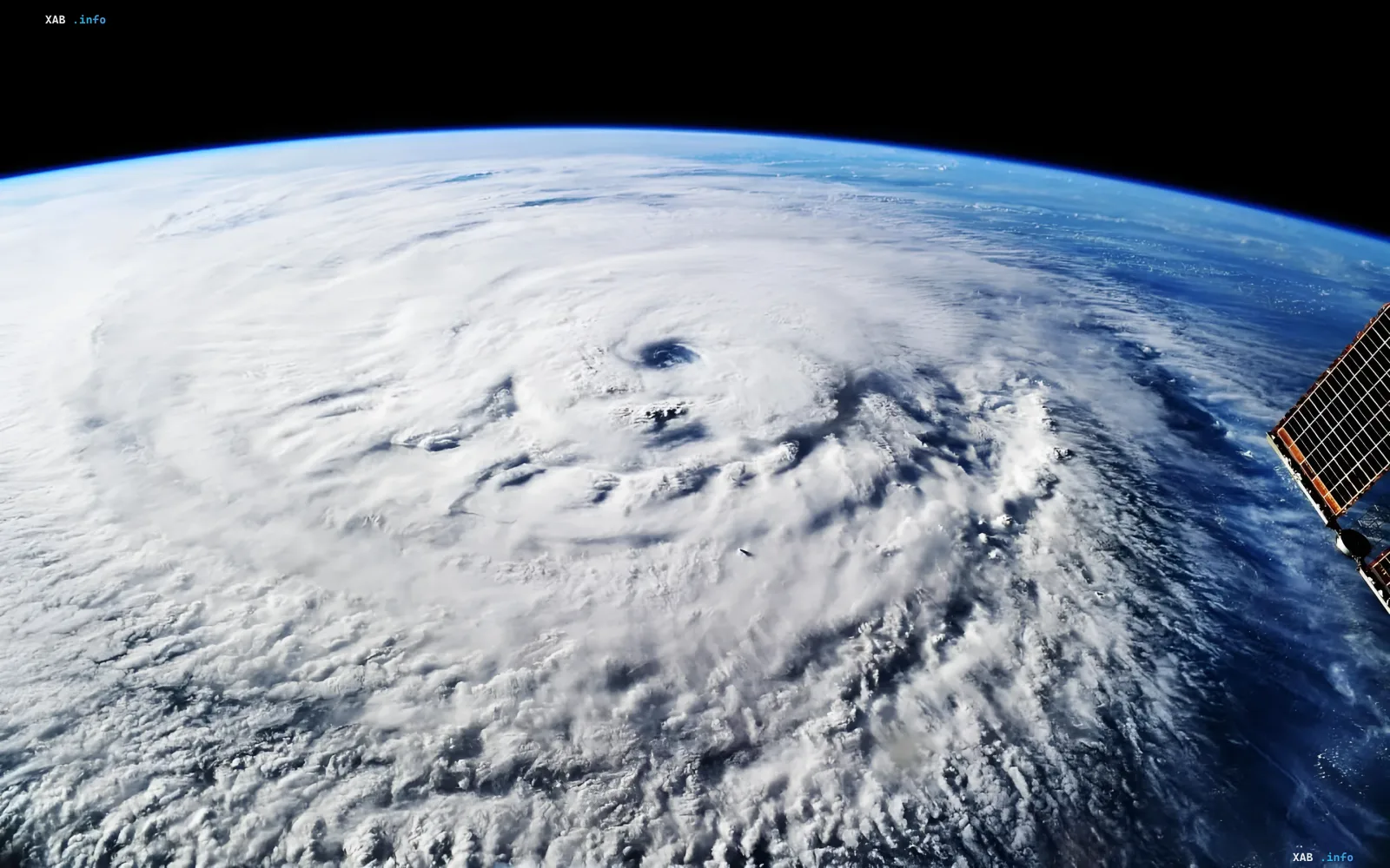
In August 2026, the meteorological community marks the one-year anniversary of how Google DeepMind and Google Research technologies revolutionized disaster forecasting. The WeatherNext AI model, developed to analyze atmospheric processes, has demonstrated the ability to give meteorologists approximately one extra day of lead time for accurately predicting the development of tropical cyclones compared to traditional methods.
A Breakthrough in Accuracy: 3-Day Forecast vs. 2-Day
The model's main achievement lies in shifting the time horizon. WeatherNext's forecast made 3 days in advance is, on average, comparable in accuracy to a traditional 2-day forecast. This is a critical advantage in the fight against hurricanes, where every hour can save lives. The model has already been tested in real-world operational conditions for meteorologists, and the results were so high that they even surprised the developers.
A Success Story: Hurricane "Melissa" and the Rescue of Jamaica
The most illustrative case of the technology's application was the story of Hurricane "Melissa," which struck the Caribbean basin in October 2025. Five days before the storm made landfall, WeatherNext predicted with 80% probability that the system would head toward Jamaica and intensify into a Category 5 hurricane. The forecast proved correct: "Melissa" did indeed strike the island, causing massive flooding and landslides. Thanks to the earlier and more accurate warning, authorities and rescue services gained additional time to prepare for evacuation, stockpile supplies, and deploy resources, which helped minimize human casualties.
How AI Overcame the Limitations of Traditional Models
Forecasting tropical cyclones is one of the most complex tasks in meteorology. The direction of movement depends on global processes, such as the position of atmospheric fronts, while the strength of the hurricane is determined by local conditions in the atmosphere and ocean. Previous AI models handled the trajectory well but failed in predicting intensity. WeatherNext overcame this barrier by training not only on rare cyclone data but also on a massive dataset of routine meteorological observations. This allowed the model to understand both general weather patterns and the specific development of storms simultaneously.
The Data Paradox: Why Low Resolution Works Better
Researchers were particularly surprised that WeatherNext uses atmospheric data of relatively low resolution. Traditional models require detailed information to predict hurricane intensity; however, the AI showed that large-scale data may contain more information about the future intensification of a cyclone than previously thought. Although the specific mechanism by which the model extracts these hidden patterns has not yet been established, this discovery opens new horizons for climatology.
Forecast Variability: From 50 to 1,000 Scenarios
Instead of a single linear forecast, WeatherNext creates multiple possible scenarios for storm development, accounting for the effect of small initial differences. If the model generated about 50 scenarios per storm last year, by 2026 this figure had risen to 1,000. According to specialists, obtaining such a number of variants using traditional numerical models with current computing resources is practically impossible. This allows meteorologists to assess risks with unprecedented accuracy.
Open Source and the Role of Humans
The U.S. National Hurricane Center emphasizes that the model remains a tool in the hands of experts, not a replacement for them. Google DeepMind has opened the source code of WeatherNext models to the research community, hoping that this will allow other scientists to study the reasons for the algorithm's high accuracy and understand exactly which patterns of cyclone development it extracts from atmospheric data.