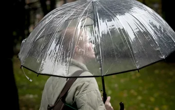
On August 28, Ukraine is expected to experience a transitional synoptic period: according to the Ukrainian Hydrometeorological Center, an atmospheric front moving in from the Black Sea will maintain unstable weather with brief rain and localized thunderstorms, while the rest of the territory will see a dry picture dominated by a high-pressure field. Overall, compared with the previous days, precipitation will decrease and air temperatures will rise modestly but noticeably. At night and in the morning, forecasters allow for fog in certain areas.
Synoptic conditions and the source of the cool air
The key factor for the weather on August 28 remains the influx of cool air from the northeast, as noted by specialists at the Ukrainian Hydrometeorological Center. It is this air mass that forms the predominantly northeast wind at 5–10 m/s and holds back any sharp temperature increase, despite the general upward trend. Variable cloud cover and the alternation of frontal and anticyclonic zones make the day's weather unstable, but overall drier than the preceding 24 hours.
Precipitation, thunderstorms, and wind
Brief rain, and in some places thunderstorms, will be associated with the passage of the atmospheric front from the Black Sea; elsewhere in the country, precipitation is unlikely due to the dominance of high pressure. The wind will remain northeasterly at 5–10 m/s, typical of a cool air mass. Fog is possible in places at night and in the morning, so drivers and pedestrians should account for reduced visibility in the early hours.
Kyiv and Kyiv Oblast
For the capital and Kyiv Oblast, the forecast for August 28 is calmer: variable cloud cover with no precipitation is expected. This means that in Kyiv the frontal activity with rain and thunderstorms, characteristic of the southern and coastal regions, will be virtually absent, and the weather will be predominantly dry and comfortable for outdoor activities.
Contradictory data
It is important here to distinguish two different time horizons that are sometimes mixed up in public discussion. The short-term forecast for August 28 from the Ukrainian Hydrometeorological Center emphasizes the influx of cool air from the northeast and only a modest temperature rise alongside decreasing rain. At the same time, broader reviews of the end of August, in particular materials citing expected local maxima of up to +37 °C with thunderstorms and strong wind, describe the final phase of the month, when heat may return in patches. In other words, "a cool August 28" and "heat up to +37 by the end of August" are not the same event but different stages: the former refers to a specific day with frontal coolness, the latter to potential warm spikes in the last days of the month. Readers should orient themselves by the date to which a given forecast is tied.
End-of-month context
Beyond the daily forecast, forecasters generally characterize the second half of August as a period in which an anticyclone covers Ukraine, alternating dry and unstable episodes, with individual days bringing local heat and thunderstorms. In parallel, the meteorological center notes accompanying seasonal phenomena: rivers are running low in several regions, and reservoirs show an abnormally low water level. Thus, August 28 becomes the link between a cool frontal day and the more contrasting weather picture of the last days of summer.