On August 9, 2026, the world faced massive natural disasters spanning two continents. While Canada is battling one of the largest wildfires in the last decade, the Southeastern United States is facing the threat of flash floods. The situation in British Columbia, where fire has engulfed the Bold Range area, has escalated to a critical threat to the population, requiring immediate federal intervention.
Wildfire in British Columbia: Evacuation and Destruction
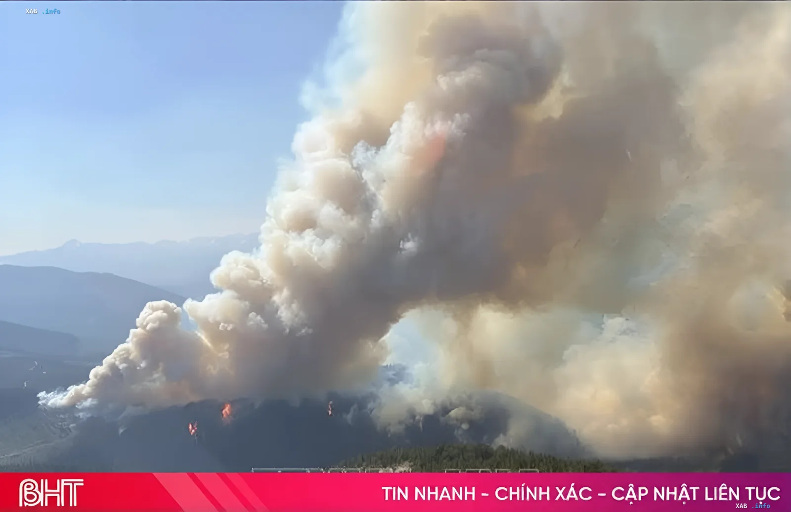
Late in the evening of August 7, 2026, strong winds became the catalyst for the rapid spread of a wildfire in the Bold Range area. Fueled by gusts of wind, the flames surged towards the city of Summerland and affected settlements in nearby valleys. British Columbia Premier David Eby confirmed that the fire has caused significant damage to private homes and infrastructure. He stated that the speed of the fire's spread was so high that some residents found themselves trapped in their homes.
Provincial authorities were forced to initiate a large-scale evacuation, including airlift operations. Canadian Prime Minister Mark Carney, in a statement on social media, confirmed the federal government's readiness to provide full support to the province, allocating resources for evacuation and firefighting. The situation remains tense, and conditions for fire brigades are expected to worsen further due to weather factors.
Flash Flood Threat in the Southeastern US
Parallel to the fires in Canada, millions of residents in the Southeastern United States have received warnings about the danger of heavy rains and flash floods. A large amount of tropical moisture moving from the Atlantic continues to affect the states of Florida, Georgia, South Carolina, and North Carolina. Authorities have classified the South Carolina coast, particularly the Charleston area, as a Level 2 flash flood risk zone on a four-point scale. A larger area, stretching from southern Florida to Wilmington, is in a Level 1 risk zone.
Meteorologists warn that in areas where storms move slowly, local precipitation could reach 50-70 mm in a short period. This amount of water is sufficient to rapidly flood low-lying areas with limited drainage. In some regions, significant precipitation has already fallen in previous days, further increasing the risk of flooding and creating a danger to transportation infrastructure and residential homes.
2026 Hurricane Season: NOAA Forecast and El Niño Impact
The current weather anomaly coincides with the updated forecast for the 2026 Atlantic hurricane season. The National Oceanic and Atmospheric Administration (NOAA) forecasts a below-average season, expecting between 7 and 13 named storms. The probability of this scenario has been raised to 75%, primarily due to a strong El Niño phenomenon, which is expected to persist until autumn. Despite forecasts for a relatively calm season, US authorities recommend that residents in high-risk areas regularly monitor weather forecasts and flood warnings, especially when driving during heavy rains.
Contradictory Data and the Dual Effect of Precipitation
While rain poses a flood threat, it also has positive consequences for some areas experiencing water shortages. In Florida and southern Georgia, a prolonged drought is observed, so heavy rainfall could help alleviate the situation and replenish reservoirs. However, experts emphasize that excessively heavy rain over a short period can still damage transportation, homes, and infrastructure, creating a paradoxical situation where water is simultaneously a savior and a threat.