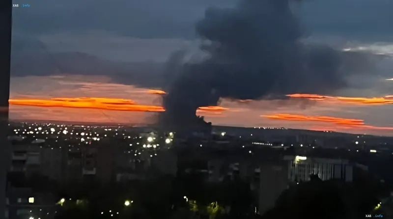
On the night of August 15, 2026, an incident occurred in the Russian provinces that set a precedent for modern military analysis. Long-range air attack systems covered more than 900 kilometers, reaching the industrial zone of Samara, where the JSC "Progress Rocket and Space Center" (RSC "Progress") is based. The attack demonstrated not only the expansion of the geographical reach of precision systems but also fundamental changes in the tactics of overcoming tiered air defense (AD).
Geographic barrier and logistics of long-range strikes
The Samara industrial complex has historically been positioned as a deeply tiered rear center, far from the line of contact. The straight-line distance from the state border of Ukraine to Samara is approximately 900–950 km. However, the actual flight trajectory required to bypass closed zones and AD positional areas increases this figure to 1100–1250 km. The scale of such an operation imposes strict requirements on management autonomy: at distances over 500 km, continuous direct radio command control becomes impossible, requiring the use of programmable autopilots with complex inertial navigation units and anti-jamming satellite receivers.
Inventory of means: from "Flamingo" to heavy drones
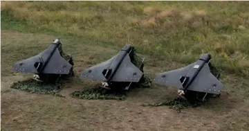
According to industry reviewers and open sources, heavy aircraft-type unmanned complexes and prospective cruise missiles were used to strike deep into the Volga region. In particular, the use of the "Flamingo" complex is mentioned, capable of carrying a warhead weighing 100–250 kg to a range of up to 1000 km. Heavy UAVs with piston engines, having a flight range of up to 1800 km, could also have participated in the attack. A key feature of these platforms is the use of autonomous flight via waypoints using a digital terrain map, which allows minimizing radio visibility.
Terrain corridor tactics and radar bypass
Overcoming the tiered radar network was achieved by using natural geographic shelters. The attacking means employed low-altitude flight tactics (30–60 meters), following the beds of the Volga and Don rivers. Such a profile places aircraft beyond the detection range of ground-based radars due to the curvature of the Earth's surface. Flight over the water surface additionally reduces the contrast of the reflected radio signal, creating a "radio shadow" effect from coastal elevations.
Contradictory data
There are discrepancies in sources regarding the exact type of weapons used and the scale of the damage inflicted. While the Ukrainian command and the "Fire Point" group (Source ID 4) confirm the use of "Flamingo"-type cruise missiles and point to the strategic nature of the strike against the Russian Federation's space programs (Source ID 3), Russian sources and the General Staff (Source ID 1) provide refined data that may differ in details describing the trajectory or type of munitions. Some analysts point to the possibility of using various types of drones to overload AD channels, while others insist on the use of exclusively high-precision missile systems.
Vulnerability of rear infrastructure
The incident revealed systemic problems in ensuring the security of industrial agglomerations. Short and medium-range systems, such as the "Pantsir-S1" and "Tor-M2", are primarily concentrated around critical military bases, leaving peripheral industrial quarters vulnerable. Dense urban development limits the ability to deploy fire positions for SAMs, narrowing the zone of effective interception of low-flying targets directly upon approach to the objects. This creates a critical gap in the zonal and object defense system, which requires a revision of AD placement strategies.