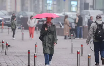

Over the coming days and until the end of next week, Ukraine is expected to experience changeable weather, in which precipitation will be determined by the passage of atmospheric fronts, while temperatures will be shaped by the collision of air masses with different properties. This was explained in a blitz interview for RBC-Ukraine by Ivan Semylit, a forecaster at the Ukrainian Hydrometeorological Center. According to him, the key "driver" of the weather will be a cyclone moving from the territory of Hungary and Romania: it will first shift in a north-easterly direction and then turn to the east. The atmospheric fronts associated with it will separate a cool air mass in the west and north of the country, a somewhat warmer one in the central regions, and the warmest one — first in the south, then in the south-east and east. Under such conditions, air pressure and humidity will undergo noticeable fluctuations, which will create a regional contrast in the weather.
Saturday, September 12: rain and thunderstorms in the west and north
In the next 24 hours, on September 12, cloudy weather with clear spells and moderate rain, locally intensifying to heavy levels in places and with thunderstorms in some areas, is expected in the west, north, and Vinnytsia Oblast, and during the day — in most of the central regions as well. Overnight temperatures in these regions will be +10…+15°C, while during the day in the west and north — +15…+20°C, which, according to the forecaster, are already "quite autumnal values," whereas in the central regions the air will warm up to +24°C. In all other regions, partly cloudy conditions will persist without precipitation: +13…+18°C overnight and +25…+30°C during the day.
Sunday and Monday: the cyclone shifts eastward
On Sunday, September 13, the cyclone shaping the weather will continue to move, so moderate rain is expected in most of the central, Kharkiv, Odesa, and Mykolaiv oblasts, with local intensification to heavy levels possible during the day in Odesa and Mykolaiv oblasts. Overnight temperatures will range between +15…+18°C, dropping to +8…+13°C in the west and north; during the day +18…+24°C is expected, and in the east and south-east — +25…+30°C. On Monday, September 14, the center of the cyclone will be concentrated over the south-east of the country and will move eastward: local brief showers with thunderstorms are expected in most of the central, southern, and Kharkiv oblasts, with overnight temperatures of +8…+13°C and daytime temperatures of +18…+24°C, while it will be warmer in the east and south-east — +13…+18°C overnight and +22…+27°C during the day.
September 15–16: a new front in the west and weather stabilization
On Tuesday, September 15, residual processes from the departing cyclone will persist in the east, while a new atmospheric front will appear in the west — it is these two baric formations that will shape the day's weather: brief showers with thunderstorms will occur in places on the Left Bank and during the day in the west of the country, with overnight temperatures of +10…+15°C and up to +18°C along the seacoast. On Wednesday, September 16, an area of high atmospheric pressure will spread over Ukraine from the south-west, and weather without precipitation will be established across the entire country, with temperature values close to those of the 15th.
Consultative forecast for September 17–20 and wind characteristics
Looking at the consultative forecast for September 17–20, the forecaster expects periodically rainy weather with precipitation of varying intensity — in some regions there will be more of it, in others less — while temperature values will not change significantly compared to the previous days. As for the wind, over the next three days it will predominantly come from the north-east at a speed of 5–10 m/s; on September 15 it will shift to a predominantly northerly direction.
Contradictory data
Different media outlets and forecasters characterize the source and scale of the cooling differently. In his interview with RBC-Ukraine, Ivan Semylit notes that the cyclone is forming over Hungary and Romania, and that the minimum overnight values in the west and north will be +8…+13°C. Meanwhile, in Obozrevatel materials the same period is described through a "Turkish" cyclone capable of bringing cooling down to +6°C and a sharp contrast with daytime +30°C. Thus, two versions coexist in the public space: a moderate regional cooling from the west (the UHMC version) and a harsher "Turkish" cyclone with a deep temperature drop (the version of a number of media outlets). The exact trajectory and intensity of the cyclone, and therefore the actual minimum temperatures, will be clarified as it moves.