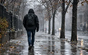

The synoptic situation in Ukraine will begin to change significantly from November 21, 2026: the current cyclone, which is gradually losing activity and moving eastward outside the country, will be replaced by a cold atmospheric front from the northwest. This was stated in a flash interview for RBC-Ukraine by Natalia Ptukha, head of the media relations department at the Ukrainian Hydrometeorological Center. According to her, the weather will "set to the character of very late autumn, even with certain notes of winter manifestations." Pressure will begin to fluctuate, and humidity will remain at a high level.
Saturday, November 21: rain, sleet in the west, and gusty winds
On Saturday, light to moderate rain is expected in most regions of Ukraine. In the west of the country, sleet will occur in places, associated with the passage of a cold atmospheric front. Temperatures throughout the day will range from +2 to +8°C, while in the central and southern regions, the air will warm up to +9…+14°C during the day. The wind deserves special attention: mainly westerly, with gusts of 15–20 m/s in the Carpathians, eastern regions, as well as at night in most central regions and in the Zaporizhzhia region. On November 22, the wind will shift to southwesterly at a speed of 7–12 m/s, and on November 23, gusts will move to the southern part of the country.
Sunday and Monday: southern cyclone, icy conditions, and "real first snow"
During November 22 and 23, the weather in Ukraine will be complicated by a southern cyclone. On Sunday, moderate, and in places significant, rain is expected in the western and northern regions. Some winter manifestations are already possible: wet snow sticking, icy conditions, and ice on the roads. Meteorologists emphasize that it is during these days that the residents of the west, north, and partly the center (on Monday) will see the "real first snow" — not small, but associated with cyclonic activity. At the same time, it will be wet, as temperatures will not immediately drop below zero. Night temperatures from Sunday to Monday will drop from +2°C to −4°C, so the snow cover, if it forms, will partially melt. In the south of Ukraine, temperatures will remain above zero during these days — a fairly comfortable regime for November.
Probability of stable snow cover and further forecast
According to the UkrGMC, there is a probability of snow cover formation on Monday, November 23, in some places in the central and northeastern regions. However, the exact trajectory of the cyclone and the specific regions where it will pass will be refined as the dates approach. "A lot depends on its trajectory," notes Natalia Ptukha. "If it shifts by just a few hundred kilometers, weather conditions may manifest differently in other regions." On Tuesday, November 24, moderate precipitation is expected at night, and in the east of the country, there will be significant rain with sleet and lower temperatures in places.
What drivers and residents of the regions need to know
The main practical conclusion from the forecast: in the period from November 22 to 23, there is a high probability of icy conditions and ice on the roads in the western, northern, and central regions of Ukraine. Wet snow, precipitation sticking to wires and trees, as well as gusty winds create additional risks. Meteorologists recommend following forecast updates on the UkrGMC website, as additional warnings for specific regions are possible if the cyclone's trajectory shifts. The southern regions will remain in a relatively mild temperature regime during these days, which will help avoid winter road phenomena there.