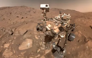

Mars lacks an orbital network of navigation satellites, which is a key limitation for the autonomous operation of robotics on its surface. Without a GPS equivalent, devices cannot reliably determine their own coordinates on uneven terrain, and thus cannot coordinate actions within a group. This exact problem is being tackled by a team from the University of Würzburg led by Professor of Satellite Communications and Radar Systems Guido Dietl. Scientists are developing a navigation system that will allow autonomous robot swarms to calculate their position and direction of movement by combining data from multiple independent sources. According to the developers, combining these metrics will give the machines sufficient accuracy to operate without external positioning. The implementation of the solution is planned in stages: first, the technologies will be integrated into ground-based prototypes and tested in field trials under Mars-analog conditions.
A celestial observatory on wheels
The second focus of the research program is the SkyCAM camera system, being developed by the group led by Professor of Space Technology Hakan Kayal. The device is designed for the automatic detection of short-lived atmospheric phenomena — lightning, cloud formations, and meteors. The system is currently being adapted for installation on the Janus Mars rover. SkyCAM tests are scheduled as part of the AMADEE-27 analog mission by the Austrian Space Forum, which will take place in Portugal from April 5 to 18, 2027. During the tests, scientists intend to deploy two or three observation stations to evaluate the system's performance in real field conditions.
The three-year VaMEx-ARES project and a 3,000-kilometer target
Both areas are combined in the three-year research project VaMEx-ARES, which started in October 2026. The work is part of the broader VaMEx initiative, running since 2012 and now entering its fourth phase of development. The main goal of the program is to explore Valles Marineris, a gigantic canyon system on Mars approximately 3,000 kilometers long. To survey this complex terrain, researchers plan to use a group of different robot types: flying, walking, and wheeled. Working together, these machines will not only be able to cover hard-to-reach surface areas but also explore subterranean caves inaccessible to conventional Mars rovers.
Earth first, then Mars
Scientists emphasize that at the current stage, the technologies are not ready to be sent to the Red Planet. All developed systems — the navigation module, SkyCAM, and swarm coordination software — will first be integrated into terrestrial robotic platforms and repeatedly tested in analog environments. Only after successfully passing field trials, including the AMADEE-27 mission in Portugal, do developers plan to transition to the Martian configuration. This step-by-step approach minimizes risks and allows algorithms to be fine-tuned in conditions where a device can be quickly repaired or replaced.
The project demonstrates a paradigm shift in Martian robotics: from single teleoperated rovers to autonomous heterogeneous swarms capable of coordinating actions without constant contact with Earth. If Dietl's navigation system and Kayal's observatory show the expected results in the 2027 field trials, it will become one of the key technological building blocks for future expeditions to Valles Marineris.